
A Voyage Is Not a View
A lost Chinese map and the third graders who knew how to read it.

Welcome to Chartography—insights and delights from the world of data storytelling.
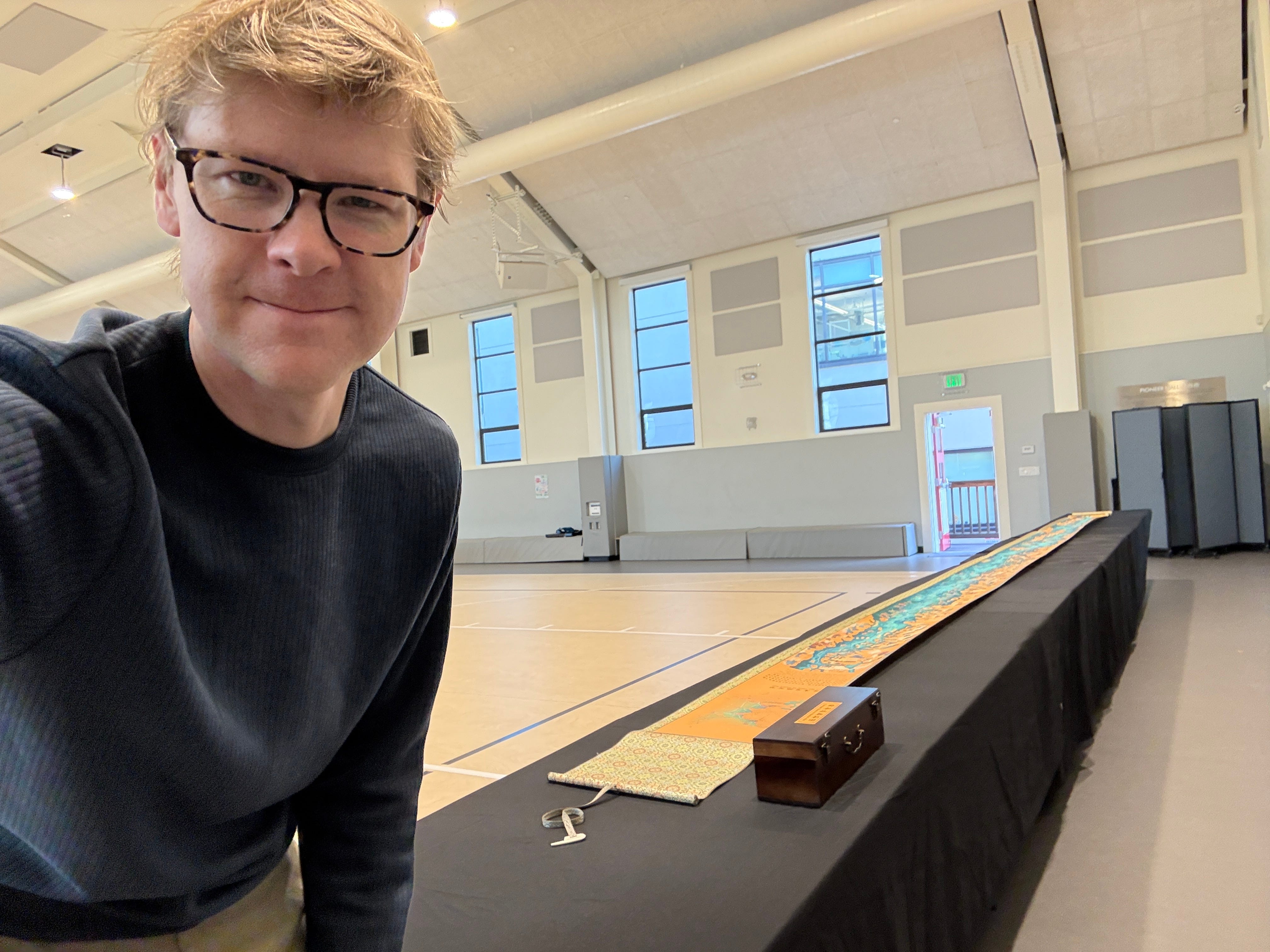
The new Zheng He scroll map is ten meters long, so a classroom was out of the question.
To show it to third graders at a local San Francisco school, we had to take over the gym. Before we talked about fleets, the Ming court, or the Qingdao cartographers who designed this map, the first lesson was spatial:
Make room.
This was not a cute logistical inconvenience. It was the point.
The map was not an image. It was an event. It had to be carried, unboxed, unrolled, leaned over, and read in pieces. Students could not stand in one place and command the whole thing. No one can. A ten-meter scroll kills the fantasy that a map is best understood as a single view.
It makes viewers perform a voyage.
This essay is a sequel to an essay about another spectacular Chinese scroll map, Echoes of the Rice Fields. That one taught us that a map is not a JPG. It was lush paper, rich ink, wooden rollers, a brocade backing, and a bridge to the Guangxi Zhuang designers who made it. It reminded me that production matters. Your canvas matters. Packaging matters. In-person matters.
The Zheng He scroll taught me something more demanding: A voyage is not a view.
Four Voyages
My story started in an American gym, but the map’s story started in Nanjing. Actually, this map carries four voyages at once.
The first is Zheng He’s voyage. Between 1405 and 1433, Zheng He commanded seven major maritime expeditions for the Ming dynasty. His fleets moved through Southeast Asia and across the Indian Ocean to Arabia and East Africa. These voyages were diplomatic, imperial, commercial, technical, and spectacular—navigational achievements of the highest order.
The second voyage is the lost scroll. The historic chart behind this new map is usually called the Mao Kun Map, 茅坤图. It is also known as Zheng He’s Navigation Map, 郑和航海图. The map is believed to derive from fifteenth-century navigational materials associated with the voyages. The National Library of Singapore describes it as a scroll in the manner of traditional Chinese painting. Some place its origin around 1430. That original scroll no longer survives.
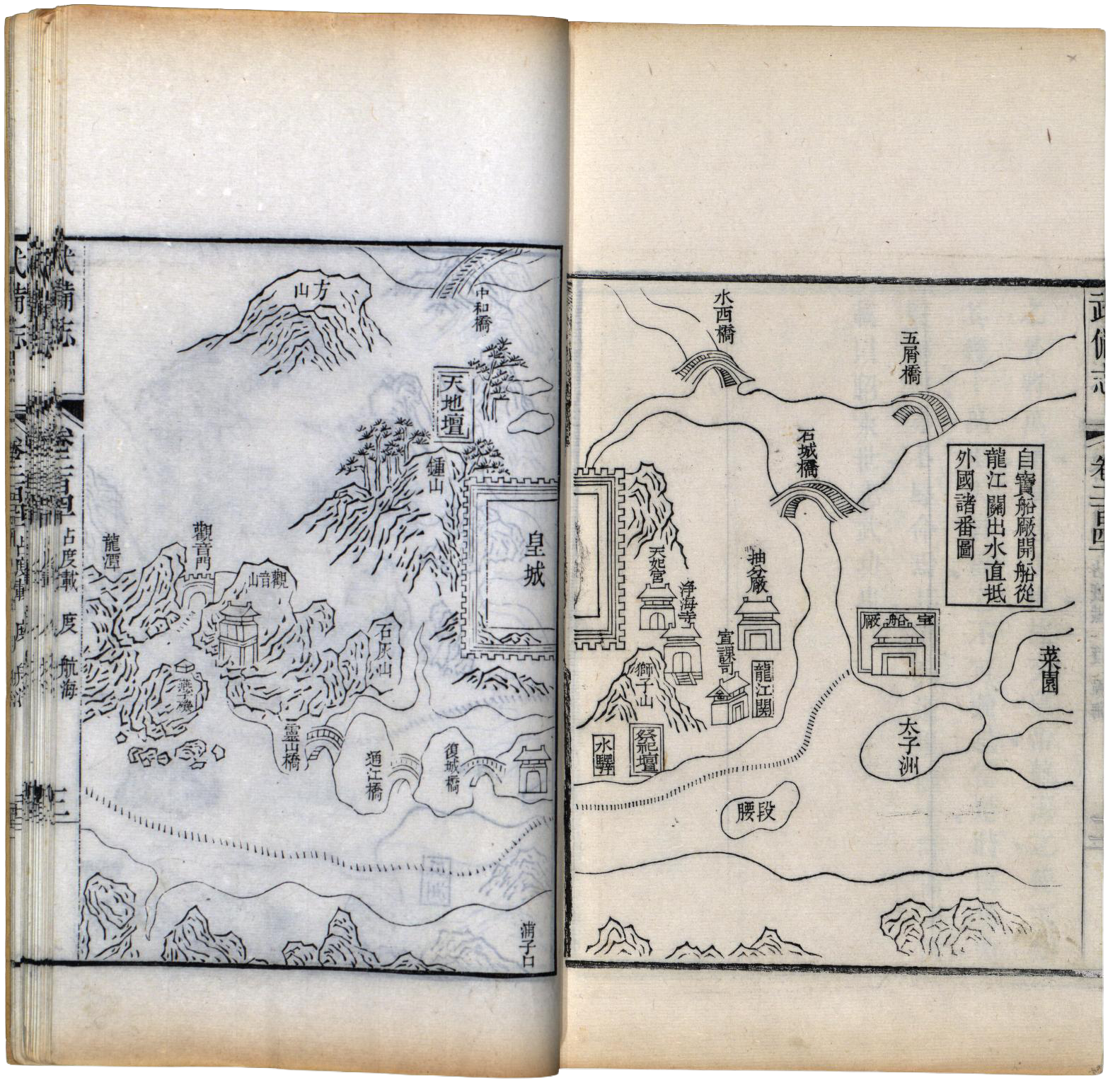
The third is the printed chart. In 1628, the map appeared in Wubei Zhi, a vast late-Ming military treatise. For that publication, the long scroll was recast into forty pages. This is the form in which the historic chart survived: not as one continuous voyage, but as a sequence of book pages.
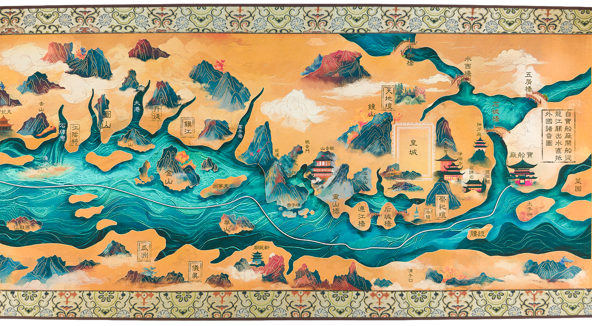
The fourth voyage is Qingdao’s new scroll. In 2025, Qingdao Surveying and Mapping Institute published Newly Compiled Chart of Zheng He’s Voyages, 郑和航海新图. It is nearly ten meters long, or in American terms: a thirty-foot voyage. It does not merely reproduce the old chart. It reactivates it, returning route knowledge to a continuous scroll while translating it to contemporary color, craft, and public spectacle.
The new scroll is not just a map of Zheng He’s voyages. It is also a story about how maps survive.
Pages Interrupt
The most important design fact is easy to miss: the old chart was not born as a page. It survived as one. That preservation came at a cost.
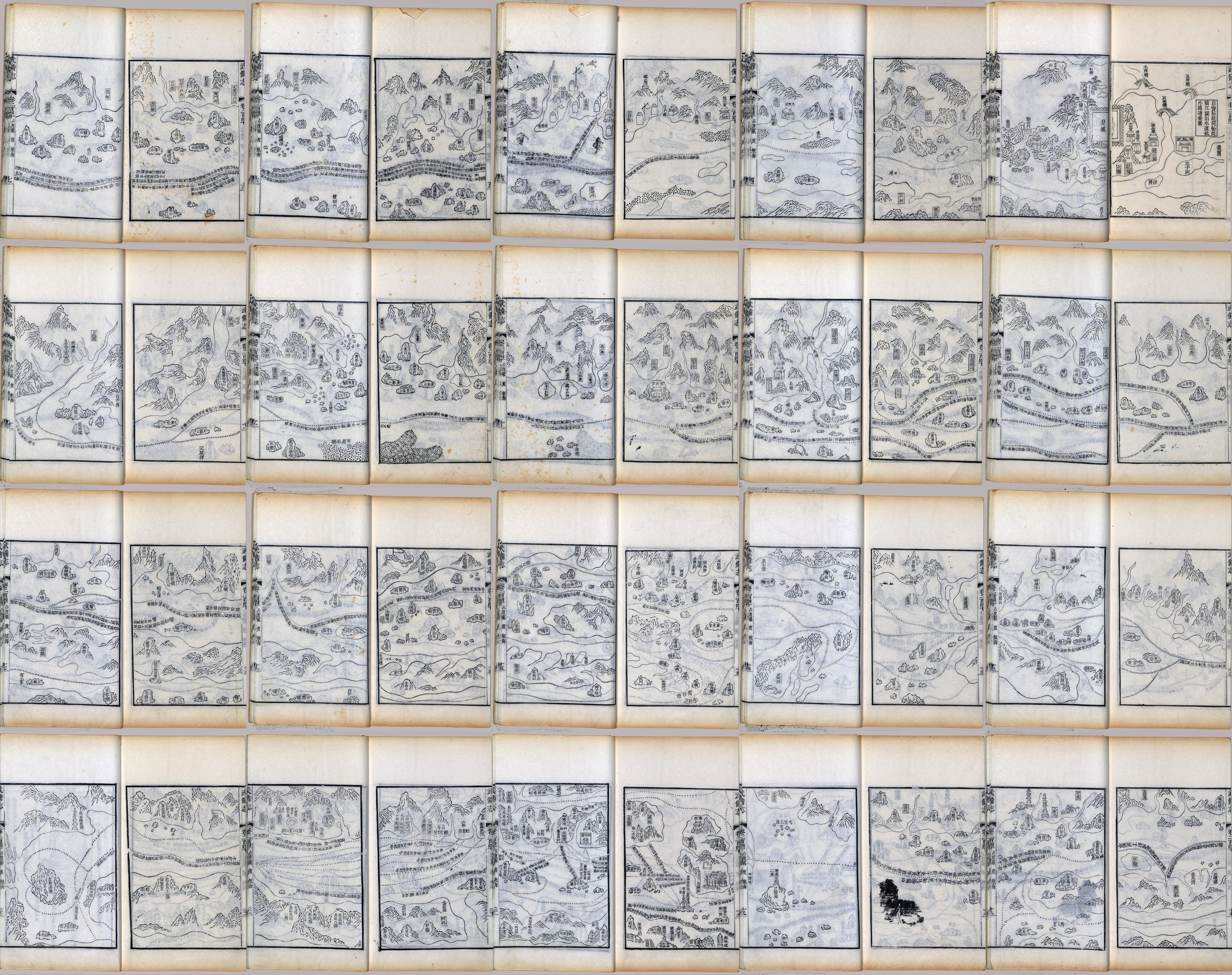
A book page interrupts the voyage. A screen thumbnail collapses it. A scroll lets it unfold.
The new Qingdao scroll does not borrow the scroll format as antique costume. It restores the map’s native grammar. Route knowledge wants duration. It wants the eye to move. It wants the reader to encounter place in sequence.
The map is an embodied experience. To read a voyage you have to move.
The Chinese characters also flow. They do not sit politely like modern labels waiting to be decoded from a stable north-up field. They follow routes, hug coastlines, bend into passages, and shift with the changing logic of the journey. This is one reason the Qingdao scroll becomes so thrilling at close range. Its characters travel too.
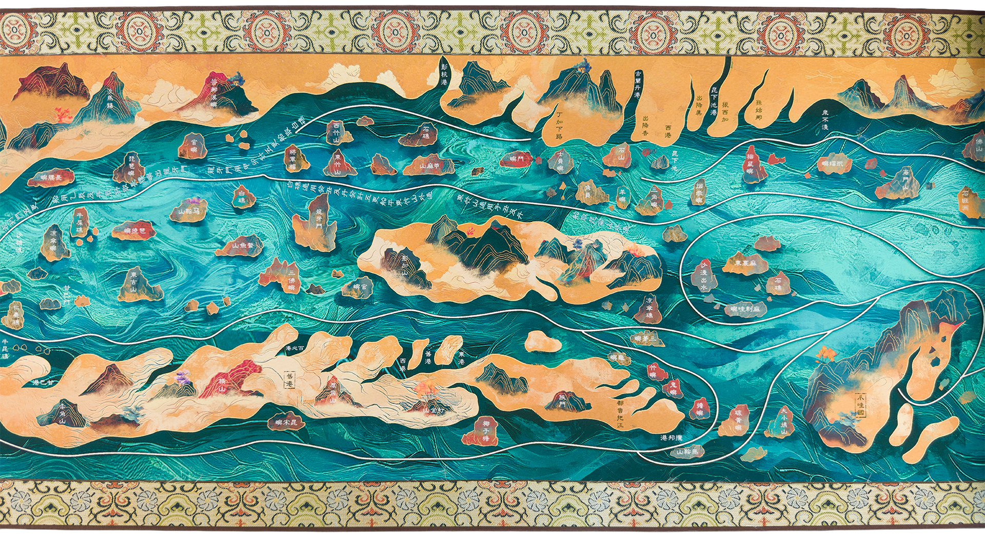
The Mao Kun chart compresses latitude, longitude, and repeated voyage-time into a long strip, from Nanjing to Malindi in present-day Kenya.
That is a tremendous geographic span to force into a strip map.
So the map appears to cheat, if we judge it by modern geometric expectations. Scale changes. Orientation shifts. Some regions stretch. Others hurry past.
But these are not failures. They are decisions. The chart does not ask What does the world look like from nowhere? It asks, How do we get from here to there? It reminds me of old family trees, which give regular spacing to events—not time. The scroll priortizes regular spacing to places—not latitude and longitude.
Qingdao
Four centuries after Wubei Zhi turned a scroll into pages, Qingdao turned the pages back into a scroll.
More precisely, the scroll comes from the Qingdao Surveying and Mapping Institute, 青岛市勘察测绘研究院, a professional surveying and mapping institution tied to national and ministry map-culture platforms. They promote their work with a philosophical attitude: 地图主义, rendered in English as MAP.ISM.
MAP.ISM is best read less as a brand than as a declaration: maps still have more lives to live, to give. Map + culture + technology. Its origins trace to 2006, when Qingdao began crossing maps with culture. The institution later became central to national map-culture platforms, festivals, alliances, and a broad catalog of experimental map objects.
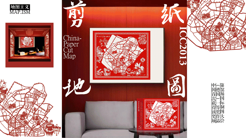
Seen one by one, Qingdao’s projects can look exuberant: ancient maps reinterpreted, paper-cut maps, blue-and-white porcelain map objects, textile and gift maps, city identity maps, and public education projects. Qingdao is not asking whether maps are useful. It is asking what else maps can carry.
Qingdao’s mapmakers belong to the sober world of official measurement, emergency surveying, geographic information, and public territory education. Yet here they are making fantastic artifacts. This is not cartography abandoning utility. It is utility invoking the radiant side of clarity.
The Thirty-Foot Scroll
Readers always want to know how a map like this arrives in my life.
The short answer is: through design diplomacy.
The long answer begins with the scroll’s exhibition at the International Cartographic Conference, finds the Qingdao team via my friend Wendy Shijia Wang, and gets exciting with an online exchange ceremony called “Cultural Exchange Through Maps and Books.” Qingdao Surveying and Mapping Institute brought their scroll map. I brought Visionary Press books. Wang Wei, 王玮, Director of the Map Culture and Creativity Center, and Liu Xiangming, 刘祥明, Deputy Director, joined with other Qingdao cartographers and designers. Zhang Jingli, 张晶莉, helped coordinate the exchange.
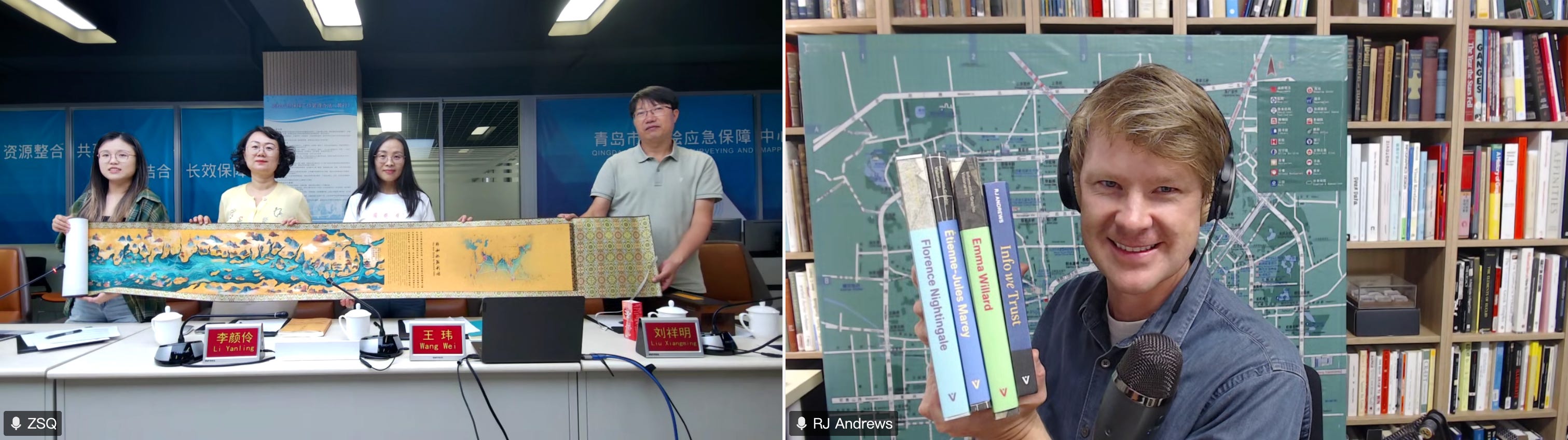
At ten meters, beauty becomes logistics.
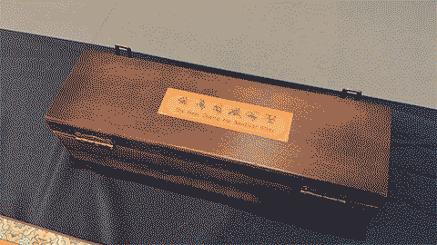
The new scroll is continuous paper mounted on cloth brocade, with wooden rollers on either end. It arrived in a wooden presentation box. This matters. Production is not secondary to the design. It is part of the design. The rollers, brocade, box, and long paper change the way people behave.
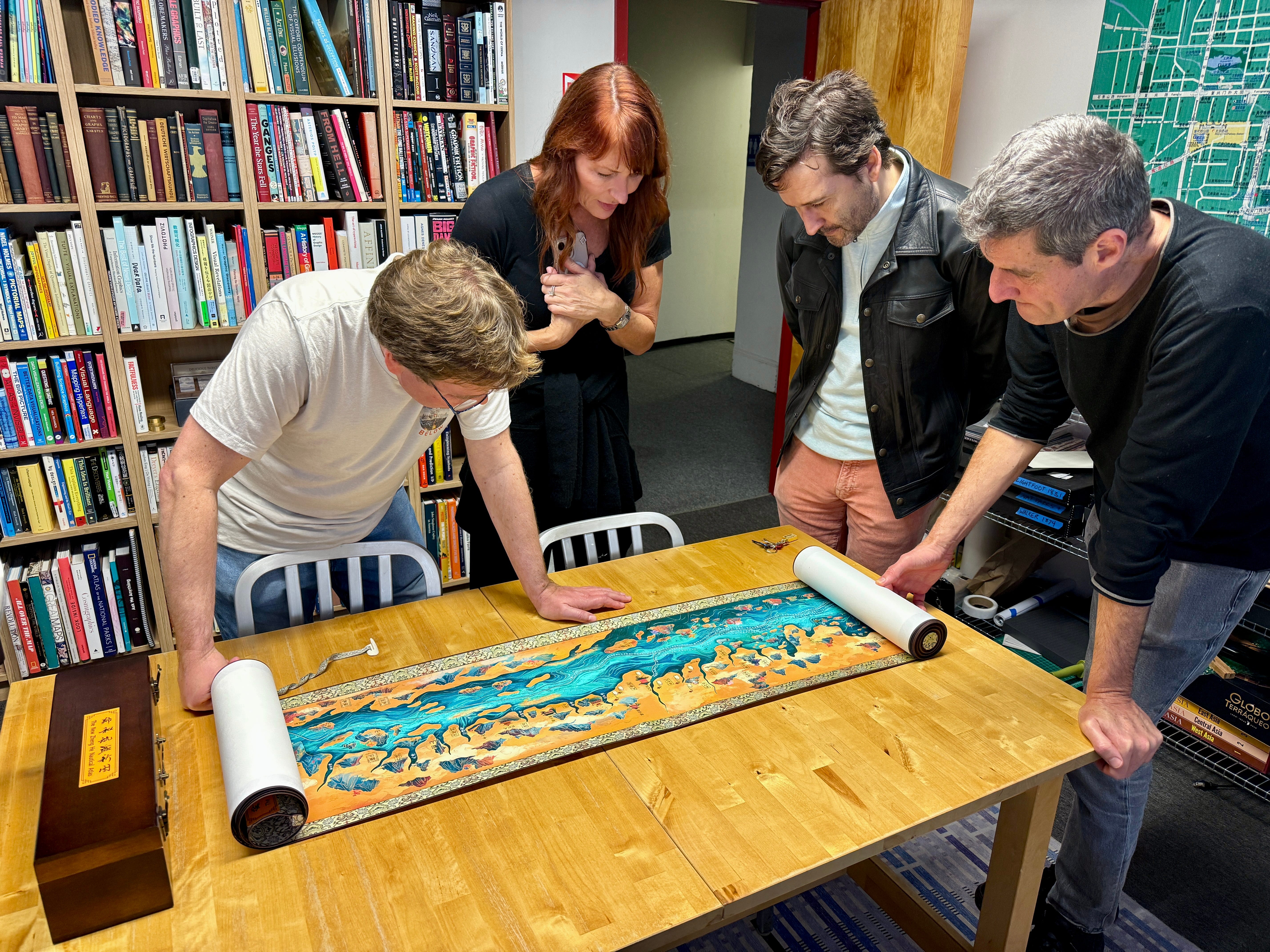
Before I brought the scroll to the school gym, I unrolled it for a few designer friends at my studio. The effect was immediate. Everyone leaned in.
It preserves original geographic markers and navigational information while enriching traditional fine-line drawing with vibrant colors and dynamic expressions characteristic of contemporary Chinese digital animation.
People get excited by its scale, then they get excited by its colors.
The old chart survives in black ink. Qingdao’s version surges with turquoise water, golden land, and magenta features, creating a visual energy that feels closer to contemporary video games than historical facsimile. This is not a reproduction. It is a reactivation.
The map is spectacular, but spectacle has a job. It attracts readers. It makes children want to lean over it. It gives adults permission to be delighted before they become scholarly.
Back in the Gym
The students had advantages many adult audiences would not: They could read the map.
A route map wants to go somewhere. The students gathered along its length, looked for labels, followed forms, compared what they saw with what they had learned.
They had already studied Zheng He. They could speak and read Chinese, so the scroll was not only a spectacular teal-and-gold object. It was legible. They could follow characters, places, routes, and visual cues that would be invisible to many adult American map lovers.
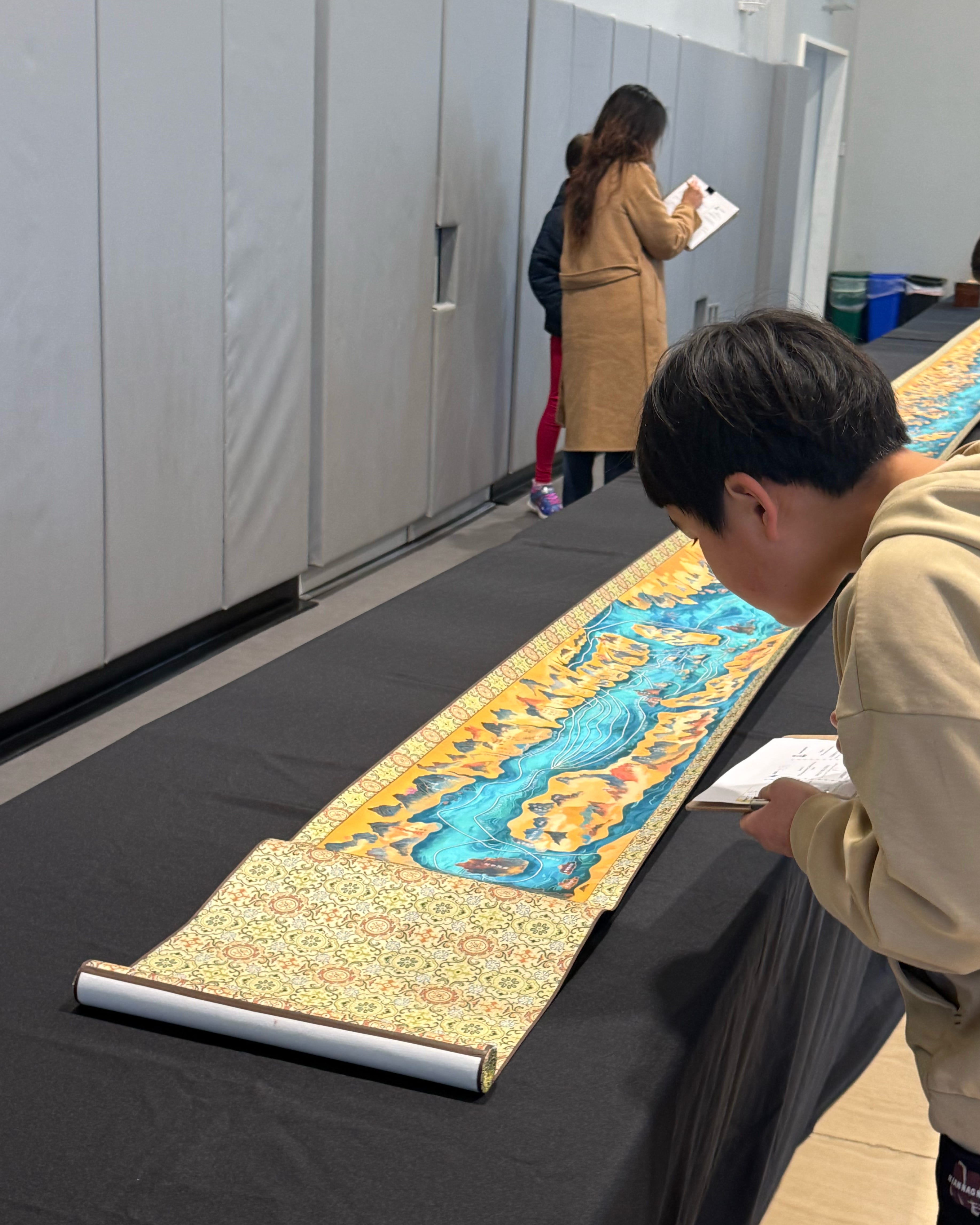
These nine-year-olds were serious map readers. The scroll gave them a map to move through knowledge they already knew.
Physical maps gather readers. They make looking social. They reward pointing, leaning, walking, and talking. They make scale felt before it is understood. They let time occupy space.
Maps are social objects. The map creates communities around itself: Qingdao cartographers, a video call, books in San Francisco, third graders in a gym, and now you, looking through these images.
Information needs artifacts. Not only designs, insights, and pixels. Not only textbook paragraphs. Not only thumbnails and captions. Artifacts. Things with surfaces. Things with weight. Things that require care. Things that command a room. Things that require logistics.
This is where Qingdao’s map-ism becomes more than a design label. It is compelling because it treats maps as cultural instruments. The Zheng He scroll is not an efficient way to deliver facts about Ming voyages. The scroll is better because it is less convenient.
Convenience is not the only virtue in learning. Friction can be good too. Good friction sparks our contemplation. The Qingdao scroll demands good friction. It asks us to slow down, handle carefully, gather around, and travel through the map in time.
Afterward, I returned the map to its wooden rollers. The scroll returned to its box. The gym returned to being a gym. But the room had already been changed.
The scroll crossed the Pacific and, for a morning, made a school gym into a map room.
The best maps do not merely represent a world. They convene one.
Onward!—RJ
About
Chartography is the newsletter of Visionary Press and Info We Trust, by RJ Andrews.
RJ Andrews is obsessed with data graphics. He helps organizations solve high-stakes problems by using visual metaphors and information graphics: charts, diagrams, and maps. His passion is studying the history of information graphics to discover design insights. See more at infoWeTrust.com.
RJ’s book, Info We Trust, is out now! He also published Information Graphic Visionaries, a book series celebrating three spectacular creators in 2022 with new writing, complete visual catalogs, and discoveries never seen by the public.
What an amazing map! I love how it "cheats" space to emphasize time and events in the narrative and, of course, the COLOR!
This is so awesome! These young students will never forget this experience.